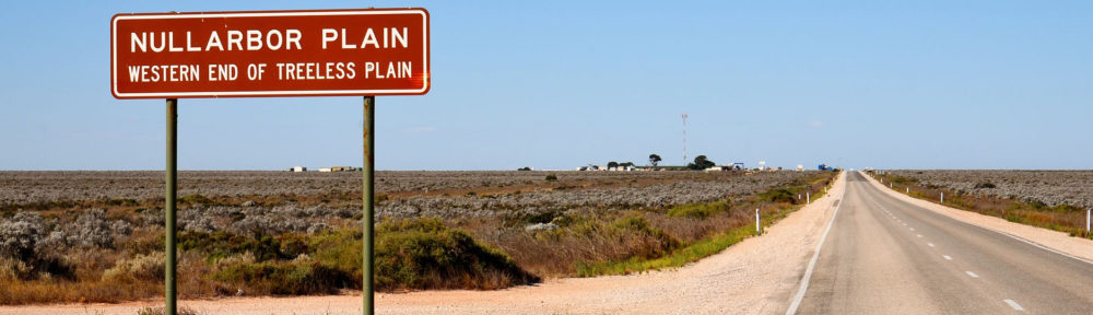
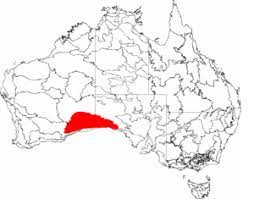
Nullarbor. It sounds like it should be an Aboriginal name but actually it is a Latin word meaning “a plain with no trees”. It is part of the area of flat, and I mean flat flat flat, almost treeless, arid or semi-arid country of southern Australia, located on the Great Australian Bight coast with the Great Victorian Desert to its north. It is the world’s largest single exposure of limestone bedrock, and occupies an area of about 200,000 square kilometres (77,000 sq mi). At its widest point, it stretches about 1,100 kilometres (684 mi) from east to west across the border between South Australia and Western Australia. In the true meaning of the word it is the Australian Outback.
Below is a short YouTube animated video that captures the essence of the area.
To view the video click on the image below……..
For me, my “Nullarbor Year” was 1969 when, for want of a bit of adventure, I decided to hitchhike from Sydney, N.S.W. to Perth, Western Australia. I had two to three weeks vacation so I figured I could get there and back in that time. If not I could jump a plane or a train and come in under the wire and save my job. A lot of the trip would be through settled areas of NSW, Victoria and South Australia where there was lots of traffic. Western Australia was a different story for right in the middle of the Nullarbor there was a huge gap in the pavement. No real road just bull dust and rubble. On a trip to the Flinders Ranges in South Australia the previous year I had already experienced the bone chattering, teeth rattling rigors of driving on outback roads. I don’t know how I thought I could avoid that experience simply by hitch hiking but I knew that the second hand VW Beetle that I owned at the time was unlikely to complete the trip in one piece. The planned trip would be around 4,000k one way – give or take a few hundred kilometers. I didn’t keep a journal of the trip but I do remember that the summer was over so I guess I set out around some time in April. I drove to my parents house on the outskirts of Sydney, said my goodbyes, left my car in their driveway, walked the hundred yards up the suburban street to Pacific Highway 31, stuck out my thumb and, the rest as they say, is history.
The initial plan was to travel down Highway 31 to Albury on the NSW- Victoria Border, then along the Murray Valley to South Australia, cut north across that state to Port Augusta, then all points west to Perth.
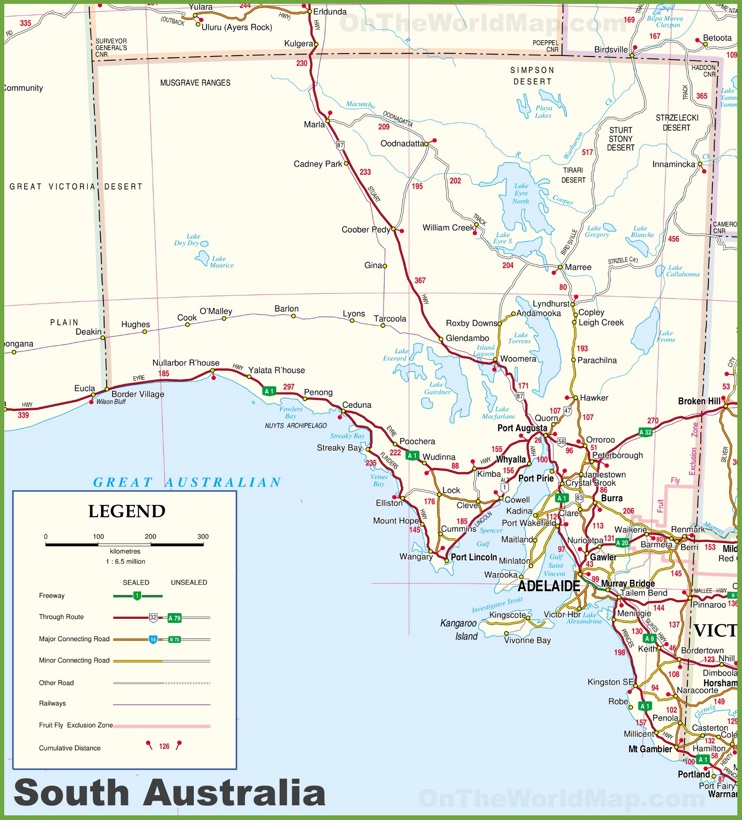
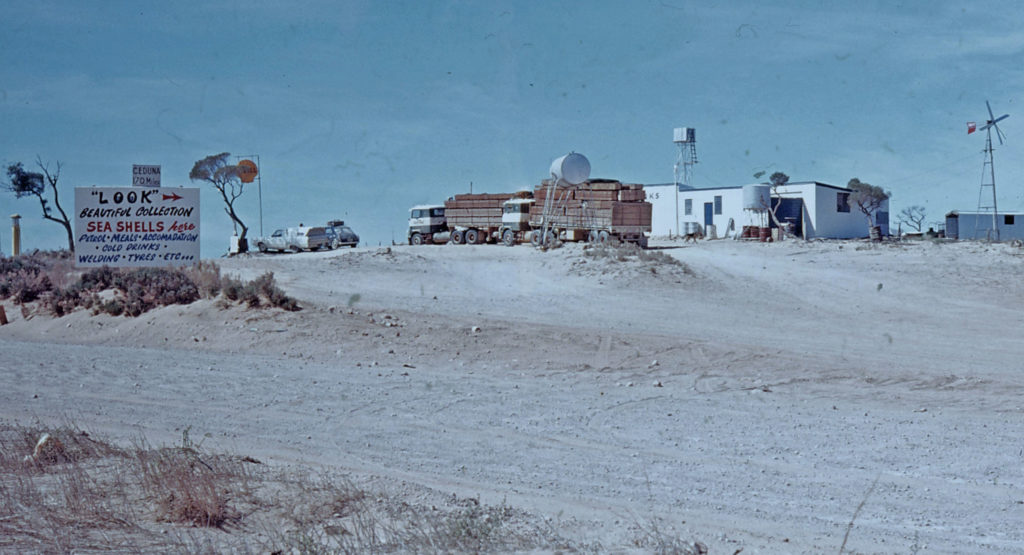
The first day went smoothly and apart from a short stop over at Gundagai to visit friends I made it down to Albury on the NSW – Victoria border in good time, hung a hard right and by late afternoon was well on my way along the Murray River Valley. In those days I did have a sleeping bag but I had no tent. So It was a case of sleeping rough. When evening fell it was over the nearest fence, roll out the sleeping bag and settle down for the night. I made no plans for inclement weather. I was relying on the benevolence of Mother Nature. As it turned out I don’t think it rained on me at any time while on the road. I do recall a shower in Kalgoolie, WA but at the time I was in town so no worries. Crossing into South Australia the days went smoothly with good weather and lots of rides with pleasant company. The only potential misadventure was a ride with a macho driver who insisting on seeing how fast his machine could go. I think we clocked 100 mph. Apart from that he was a reasonable fellow, maybe just a little crazy, who originally was from just down the road from where I lived in Sydney. The overnight stop was either in Eucla just over the border into Western Australia, or Ceduna still in South Australia. My memory is a little fuzzy on that but I do remember a great night in the local Greek club. I was into Greek food, Greek wine and Greek music at the time. I hooked up with some engineers who were working on building microwave towers across the Australian west. One guy was ex-British army. In those days British youth were conscripted into the army for two years National Service. He had spent the better part of his service in Eden, then as now, a political hot spot. He was now out of the army and was spending his new found freedom in the desert country of Western Australia. “Where was he going next?” His company was sending him to Nigeria to work on microwave towers in Biafra. Another notorious political hot spot that at the time was in the middle of a civil war. Some guys just can’t catch a break.
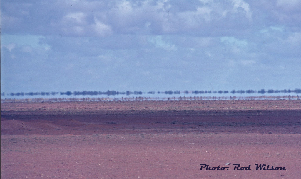
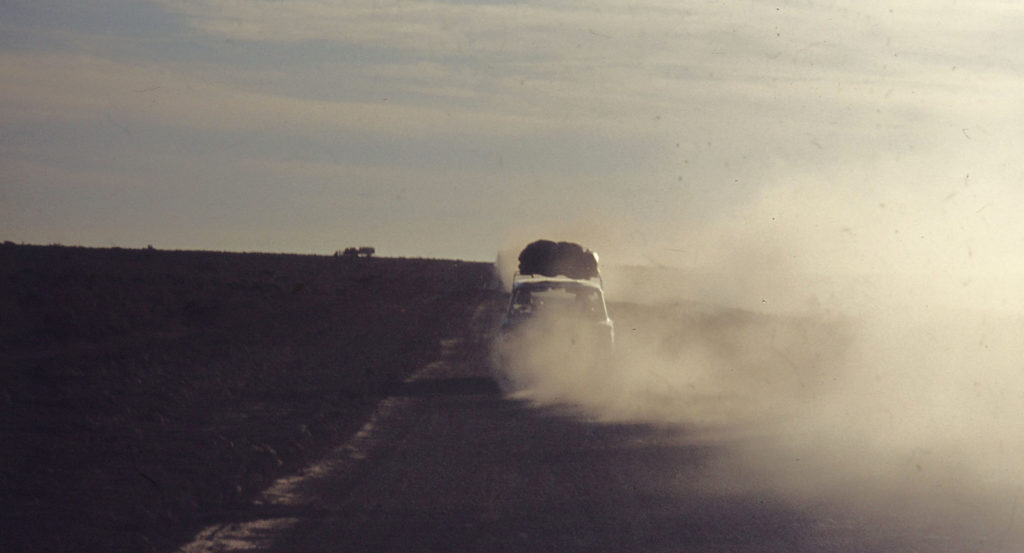
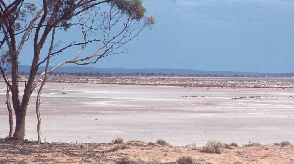
Up until Eucla the country so far traversed was mostly civilized and pastoral. Beyond the wheat belt there were some arid areas but, so far the road was paved and looking good. Once over the border into Western Australia then it was true blue Australian “Outback” dry, dusty desert country. This is the land of “the Aussie Salute” – a characteristic swish of the hand to keep the millions of moisture seeking flies away from your mouth an eyes. Just as I hit the unpaved section of the Nullarbor plain I hooked up with a convoy of two New Zealand families out to see the world. They wanted company and I needed a lift. The road was barely a road. It was packed earth overlaid with a thick helping of “bull dust”. The road just kept getting wider and wider as drivers tried to seek out the best part of the road. Here are some old photos from that section of road.
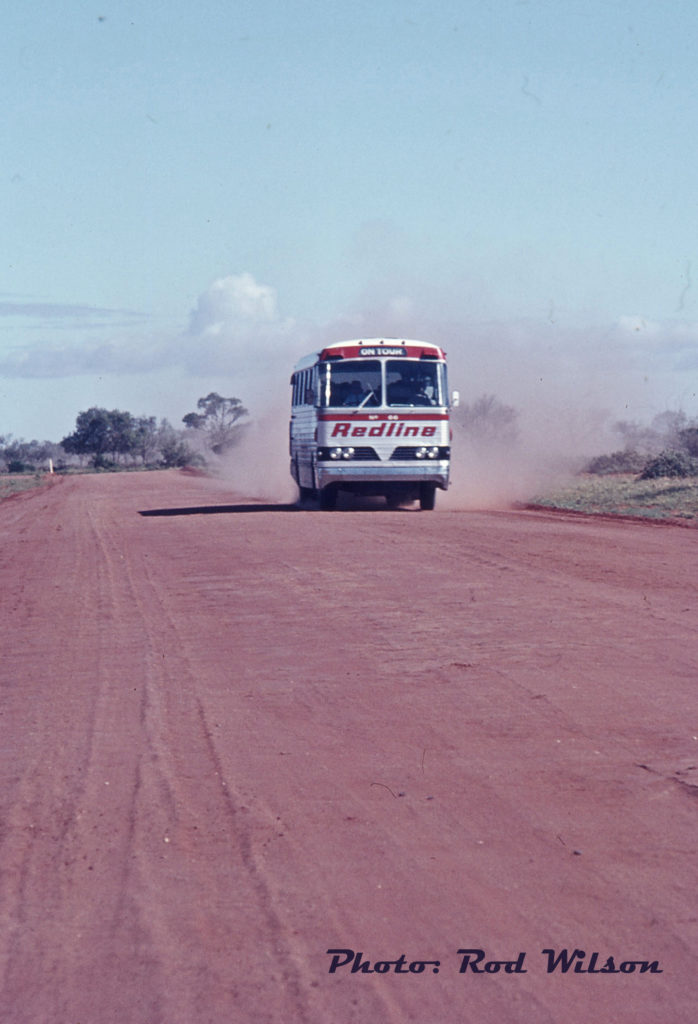
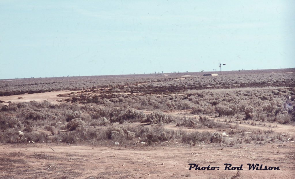
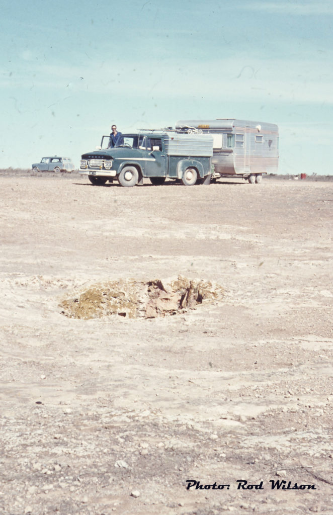
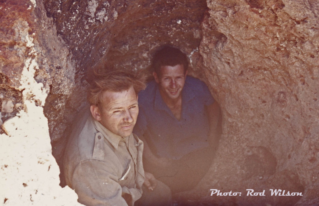
 This is the New Zealander’s convoy. That hole in the foreground is a sink hole that leads to an underground system of caves that ran all the way south under the plain to the limestone cliffs overlooking the Great Southern Ocean. By dropping down into this sink hole one can get the benefit of the cool ocean air funneled all the way from the ocean. A little touch of cool relief in a very hot landscape.
When we finally arrived back on paved highway we parted ways. The “Kiwis” wanted to take some time to clean out some of the dust before continuing. I managed a little side trip into Coolgardie and Kalgoolie. In its heyday this was one of the world’s richest gold mining areas. Mining is still the economic driver of the area and at the time of my visit it was in the midst of a huge scramble for nickel. Back east stock prices in WA nickel claims were going through the roof. 80 cent shares went as high as $280 before the bubble finally burst a year or so later.
Western Australia has some of the racial and redneck proclivities of the southern states of the USA. I saw aboriginal families on the street in Kalgoolie in pitiful condition. Mum and dad were drunk and kids were snot-faced, barefooted and in threadbare clothes. One white old timer who gave me a lift from Kalgoolie back to Coolgardie related stories from his youth when he was a boundary rider on the big cattle ranches. In those early days of the twentieth century, as a boundary rider, he was under orders to shoot “wild blacks”.
The westering desert highway ends in Perth. This is the capital city of the largest state in Australia and it perches on the south western edge of Australia. Some say that “as the crow flies” Perth is closer to Durban, South Africa than Sydney, Australia. In distance and philosophy that is probably true. Western Australia (WA) is the state least committed to the Australian Commonwealth and at the time of Australia’s independence it resisted overtures to join the proposed Commonwealth of Australia. It was only the huge influx of miners from the Eastern States to the Kalgoolie goldfields that swung the vote in favor of joining the new commonwealth. In Western Australia there is always something afoot in favor of succession from the Commonwealth. In a referendum in April 1933, 68% of voters voted for the state to leave the Commonwealth of Australia with the aim of returning to the British Empire as an autonomous territory. The WA State Government sent a delegation to Westminister to try and achieve that aim but the British Government refused to intervene. Over the years a number of movements, usually funded by big mining interests, have tried to foster succession. In setting up the Commonwealth at the time of independence the constitution was framed in such a way to prevent any state seceding from the Commonwealth. To a Canadian ear the WA rhetoric for secession is much the same as that voiced by the Canadian province of Alberta. “It is the abundant natural resources of the west that keeps the country afloat, we are underappreciated, it’s those Eastern plutocrats and bureaucrats that keep us down”. The big difference between the Canadian and Australian experiences is that Alberta is land locked and as an independent Alberta it would have to deal with that as an issue. WA does not have that problem. On every side but one the state is lapped by the ocean. It certainly makes it easy to export abundant resources. The mining companies literally shovel raw material onto conveyor belts for transport to a convenient port, dump it into the holds of huge bulk carriers for shipment to overseas markets.
After the desert of Western Australia the local YMCA with hot showers, laundromat and a regular bed with sheets was a welcome opportunity to clean up, rest up, do some sight  seeing around nearby Freemantle and contemplate how to get back home. Hitch hiking back across the Nullarbor had lost its appeal. A journey aboard the iconic Indian Pacific Train seemed like the best option. Train travels between Perth, Adelaide and Sydney on a spectacular 4352km crossing. I don’t recall what the cost was back in 1969 but I have noted that today that trip would cost you around $2,000. I had no intentions of taking it all the way to Sydney but crossing the Nullarbor to Port Augusta in the lap of luxury seemed like the way to go. The day and a half trip sure beat the hell out of another trip through all that dust. Port Augusta was as I remembered from my previous trip to the Flinders Ranges last year. Nothing special, just an industrial port on the edge of the desert at the head of Spencer’s Gulf. I didn’t retrace my previous steps across South Australia. It was a case of just heading due south, through Adelaide down to the South Australian / Victorian border then east along the Great Ocean Road.
I did some sight seeing around Mount Gambier but, unfortunately, missed some of the grander ocean views of the Great Ocean Road. I was starting to run out of time.
The final leg of the trip was through Melbourne then all points north to arrive back in Sydney in time to go back to work. In summary it turned out to be a worth while adventure. My only complaint was my lack of decent hiking boots. Back in the day no such thing existed in Australia. I did the trip wearing “desert boots”. Not really a boot, rather , a light weight suede shoe with Crepe rubber soles. The problem was that the desert boot had great ” boot to road traction” but there was a tendency for your foot to continually slip back and forth inside the shoe. The end result of a lot of walking was that the soles of my feet were on fire and towards the end of the trip it was “a bit of a pain”.
So what did my trip have to do with the YouTube video?. Well as a graphic representation of the Nullarbor section of the trip it is pretty accurate. The only thing missing is the heat, flies and the bull dust that got into everything. The only inaccuracy that I can detect is the scene where the parked car rolls away and plunges over the cliff. The Nullarbor is so flat that there is zero chance of a vehicle rolling anywhere.
@@@@@@@@@@@@@@
POSTSCRIPT: Australia is a big country of vast distances over challenging terrain that has resulted in a number of unique routes across the country/
- Australia’s Highway 1 is a network of highways that circumnavigate the country, joining all mainland state capitals and Darwin. At a total length of approximately 14,500 km (9,000 mi) it is the longest national highway in the world, surpassing the Trans-Siberian Highway (over 11,000 km or 6,800 mi) and the Trans-Canada Highway (8,030 km or 4,990 mi). A part of the highway network is traversed by over a million people every day. Highway 1 was created as part of the National Route Numbering System, adopted in 1955. Although there are many scenic spots along the highway it should be remembered that Australia is one of the driest continents on the planet and the vast majority of the highway system is across arid and semi-arid desert.
- Major Rail Routes. There are three major long distance routes in Australia. The Indian Pacific crosses the country from Sydney to Broken Hill, to Adelaide, to Kalgoolie to Perth. It is one of the few truly transcontinental trains in the world and includes the world’s longest straight stretch of railway track, a 478-kilometre (297 mi) stretch of the Trans-Australian Railway across the Nullarbor Plain. A one-way trip takes between 70.5 and 75 hours, depending on scheduling and daylight saving periods. For motorist not wishing to face the rigors of the Nullarbor a motorail service conveys passengers’ motor vehicles between between Adelaide and Perth. The Ghan – originally named the Afghan Express in honor of the early camel drivers who the crossed the deserts of Australia. This is a rail service that crosses the continent North-South and links the cities of Adelaide, Alice Springs and Darwin. Its scheduled traveling time, excluding extended stops for passengers to do off-train tours, is 53 hours 15 minutes to travel the 2,979 kilometres (1,851 mi). The Ghan has been described as one of the world’s great passenger train. The Spirit of Queensland is a Queensland Rail long distance passenger rail service. It is operated by a diesel powered Tilt Train that runs five times a week on the North coast line between Brisbane and Cairns, a distance of 1,681 kilometres (1,045 miles).
@@@@@@@@@@@@@@
Those were the days when everyone hitched a ride somewhere and people weren’t afraid to pickup hitchhikers. Thanks for sharing your adventures Rod.