This is another YouTube video that has hit my nostalgia buttons.
For more info check https://www.inafarawayland.com/rockwall-trail-guide/
@@@@@@@@@@@@@
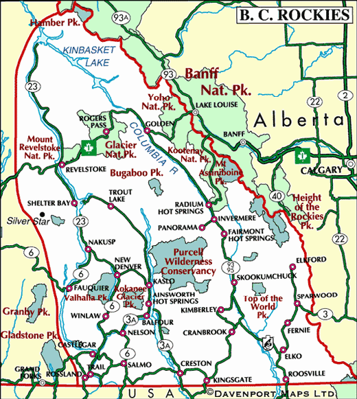
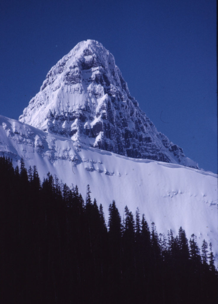
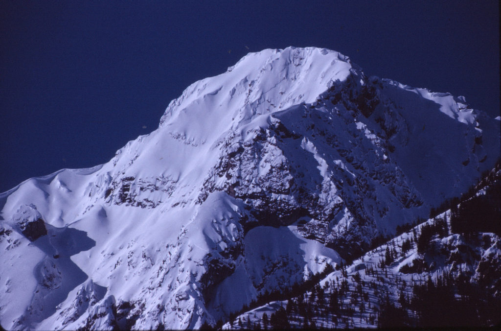
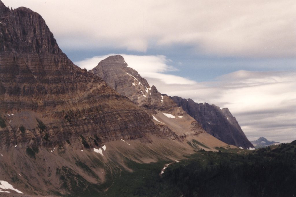
When we relocated to the Kootenays in British Columbia in the mid 1970s one of the first things we did was an April road trip into Kootenay Park followed by a circuit through Rogers Pass, Revelstoke and back down though the Arrow Lakes area to our home base in Rossland BC. As it was Easter and there was still lots of snow on the mountains and the scenery was spectacular. One of the most memorable scenes was the views of Mount Verendye and Mount Numa from Highway 93 near Vermillion Crossing. I didn’t realize it at the time that there were numerous trails that led into the area and along, what is described in this video, as the Rockwall Trail.
Over the years we had many road trips though Kootenay and Banff National parks with only a limited number of opportunities to explore the trails. As always time slips quietly by and before you knew it we had been in area nearly twenty years without having explored the potential of the area. I decided in the early nineties to remedy that situation by initiating regular late summer hiking trips into the parks. My son went off to University and my wife Mae, who is a five star hotel type of girl, had no desire to spend two weeks a year sleeping on the hard ground in the Canadian back country. So my my pattern for the next ten to fifteen years was to take two-three weeks each late summer to do solo backpacking trips in the National Parks. Every summer I would do a number of day trips and at least one multiday/7 night trip.
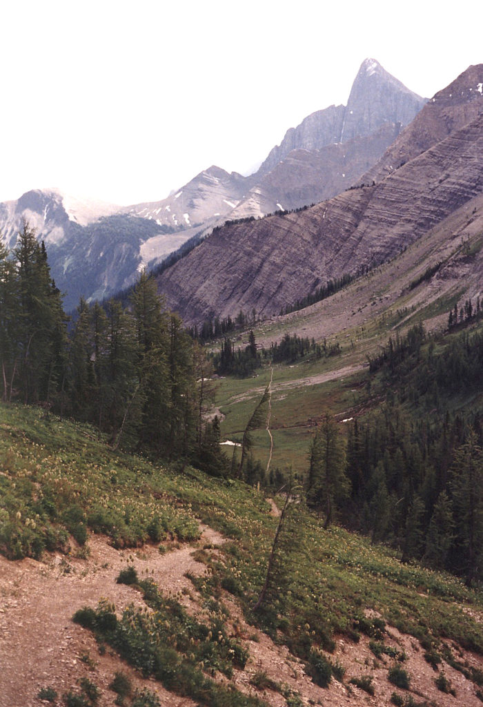
I started these endeavors in the summer of 1991.During that first summer I did a number of day hikes, including the Stanley Glacier Trail 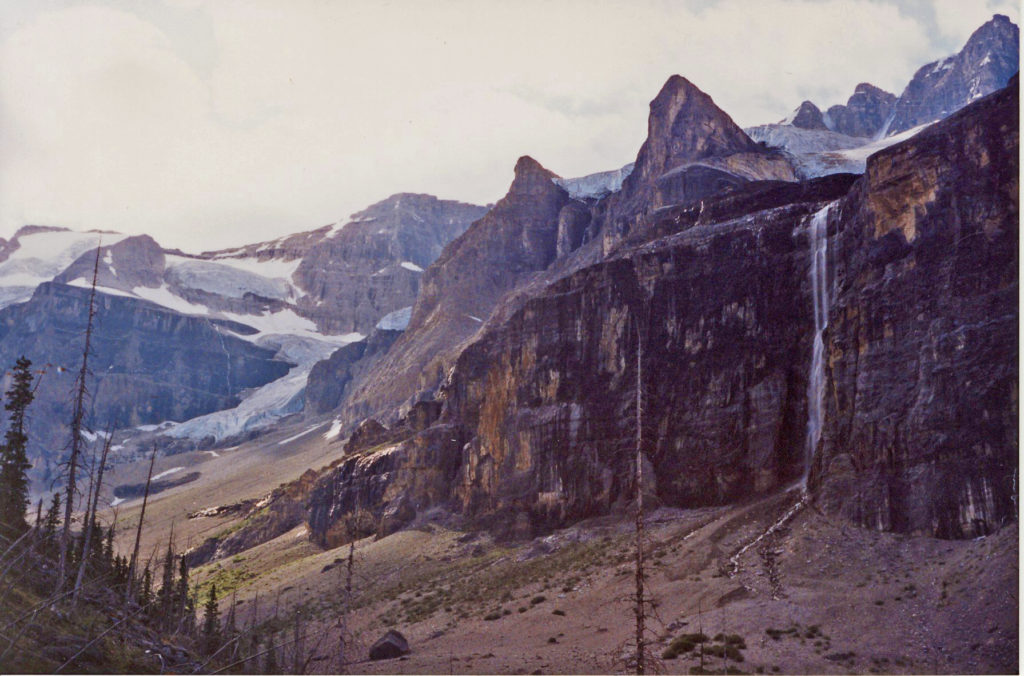 and a number of hikes to various destinations on the Rockwall Trail. The trails are very accessible from Highway 93. Often the trail head and the trail end are some distance apart. I solved that problem by leaving my bike at the end of the trail, driving to the trail head, hiking the trails, pick up the bike and cycle back to the trailhead to my vehicle. As a plan it worked well. I was staying at the Marble Canyon campsite on this trip and used that as a base for the day trips and bike tours to Vermilion Crossing and Lake Louise.
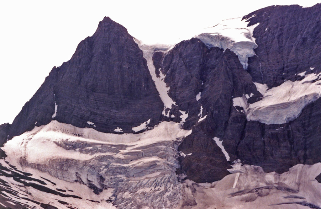
On Thursday, the twenty second of August 1991, I set out on a day trip up to Floe Lake and back down the Numa Falls Trail. As described in my journal “I started out at 8:45am on a beautiful sunny day for the two and three quarter hour, 11k hike and 2,400 elevation gain up to the lake”. It was then just a case of kicking back, eating lunch and enjoying the sun and the spectacular view of 3,000 vertical feet of mountain dropping into a beautiful lake. The black flies were a little pesky and the gophers trying to forage food from inside my backpack were very cheeky. I set out for Numa Falls and the downward trail around three o’clock. All in all it was a 22K round trip of 5 hours of actual hiking. The photos are from the Floe Lake area.
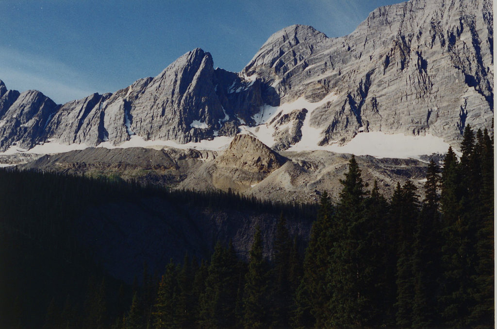
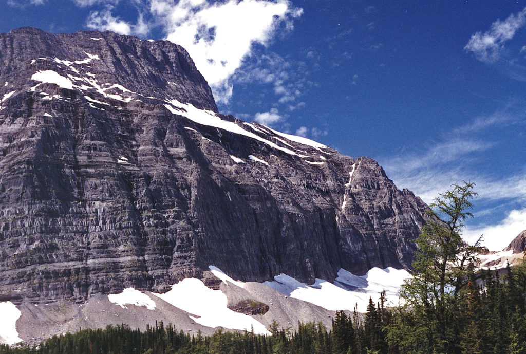
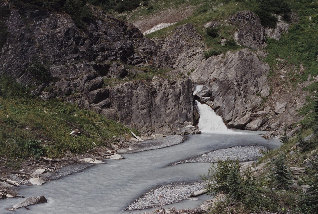
Four or fiver days later I decided to do the Tumbling Creek trail. The logistics of the trip included leaving my pack at the Paint Pots trail head, driving to the Numa Falls trail head and cycling back to the Paint Pots, hiding the bike in the bushes and doing the hike. This was done to avoid a five kilometer walk from the end of the trail back the trailhead. I was on the trail earlier enough to make it to the pass by 1315hrs. Highlights of the trip up the pass were the wild flowers, massive avalanche damage, Tumbling Creek, a scenic suspension bridge and a spectacular view looking north along the Rock Wall to Woverine Pass. Looking south there was the views of Mount Verendye and Mount Numa. The weather was a little cool after lunch when I headed off south down a very steep series of switch backs on the trail that joined up with the Numa Creek trail at Numa Pass junction. I made it to the parking lot around 16:45hrs and drove to Paint Pots trail head to pick up the bike. . All in all a 25K round trip of around 5.5 to 6 hours hiking. The guide book specifies an elevation gain of 2,700 feet and a max. elevation of 7,500 feet.
I ended that the 1991 summer vacation without accomplishing an extended overnight back packing trip. At the time I was insufficiently equipped to attempt an extended back packing trip. This was my first solo foray into the National Parks. I hiked a total of 60k and cycled 100k.
In the late summer of 1992, with the purchases of a new sleeping bag, portable stove, an upscale backpack and a warm black toque for those cold evenings I corrected some of last summers deficiencies. Once again I camped at Marble Canyon Camp Ground in Kootenay Park. To get in shape I did a number of day kikes that included the Chephen Lake / Cirque Lake trail. This is a very short easy trail in the shadow of Howse Peak (3,295 metres – 10,810 feet). This is a very spectacular, formidable mountain that, on 16 April 2019 took the lives of three of the most talented international climbers of their generation. David Lama, Jess Roskelley and Hansjorg Auer, after climbing a new route on the east face they were killed in an avalanche during their descent. That was way in the future and an endeavor that was way above my pay grade. I also did a 20 K / 5 hour day hike into the Yoho Park’s Yoho Glacier.
This year’s plan for the multi-day hike was to start from Marble Canyon Information Center parking lot and hike into the northern section of the Rockwall, with an overnight at the Ochre Camp Site, Helmet Creek, Mount Goodsir Pass into Yoho National Park, McArthur Pass and another overnight at Lake O’Hara. I am not sure of the total distance but I suspected it would be around 52k. There were some significant logistical planning required. First of all a stop to park my gear at the information center and obtain permits for the overnight camp sites. Then a drive to park the car at the end of the trail at Lake O’Harra. At 12:30 I pulled the bike out of the car and cycled the the 52k back to Castle Junction, up and over Storm Mountain and down to Marble Canyon. The climb up Storm Mountain was pretty taxing and I ended up walking the the last kilometer over the pass. I did it in pretty good time – 2hrs 10 minutes. I locked up the bike behind the cabins and was on the trail by 1600hrs
Monday Day 1- The distance to the campsite was only 7k and it only took around two hours. On setting up camp I discovered I was missing my eating utensils, a can opener and my camera. The camera was unfortunate but considering my food supply the rest were pretty essential gear. I made do with a tent peg and and rock hammer. I was the only one in the camp site for the night.
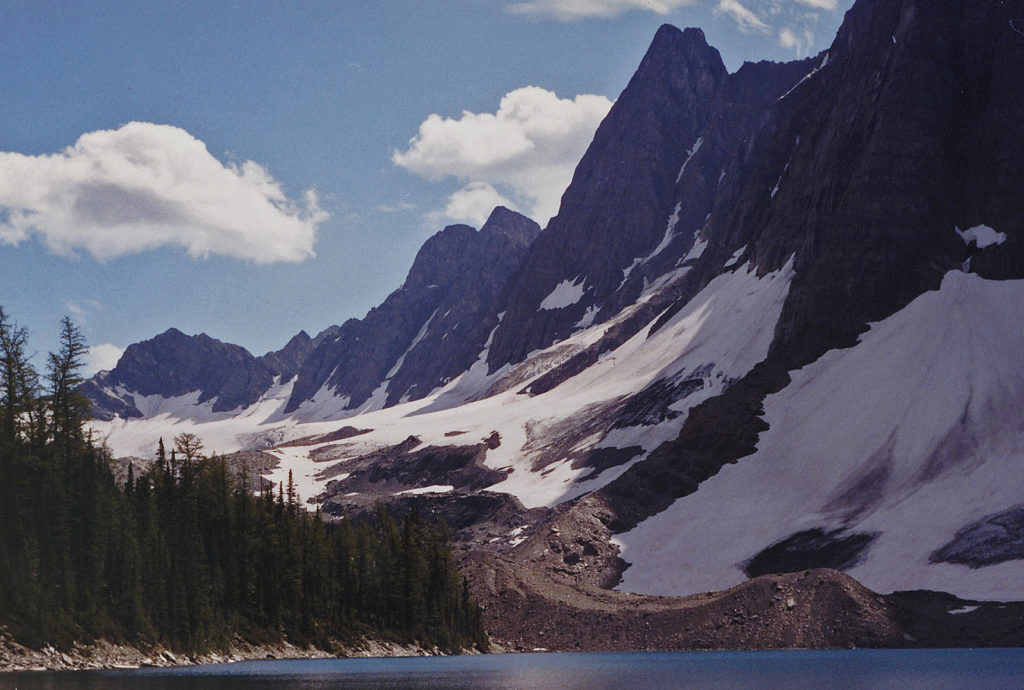
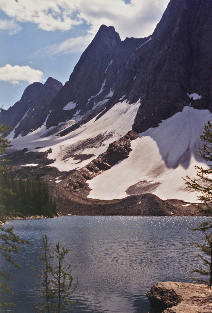
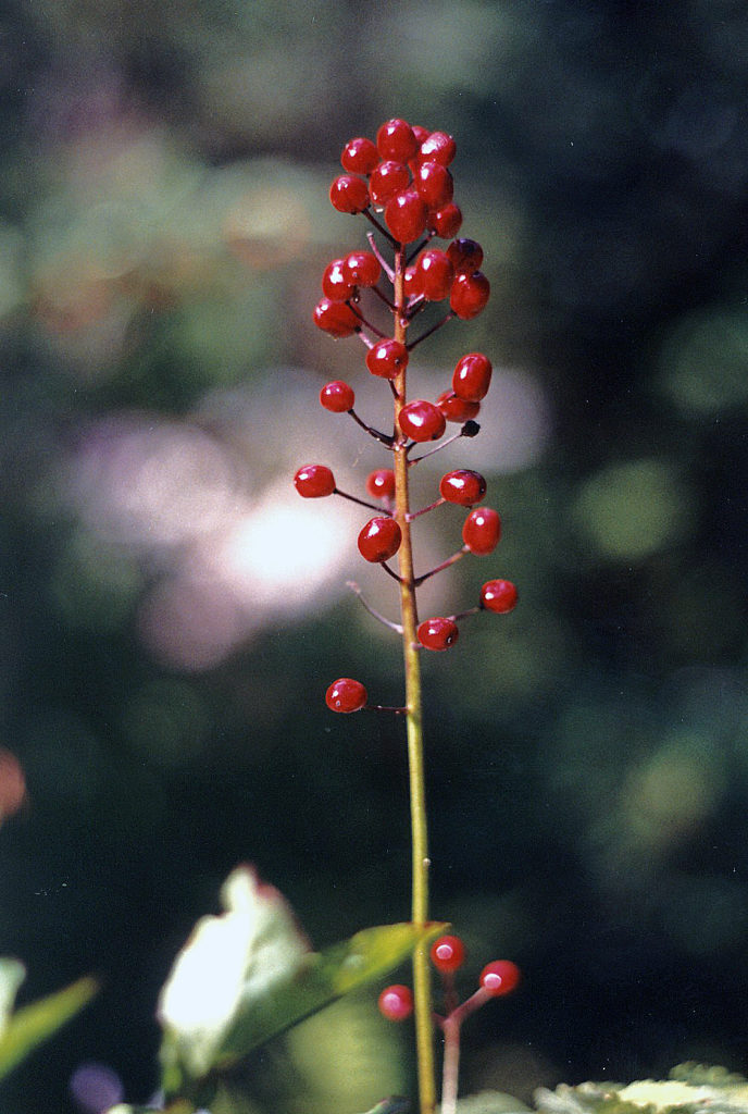
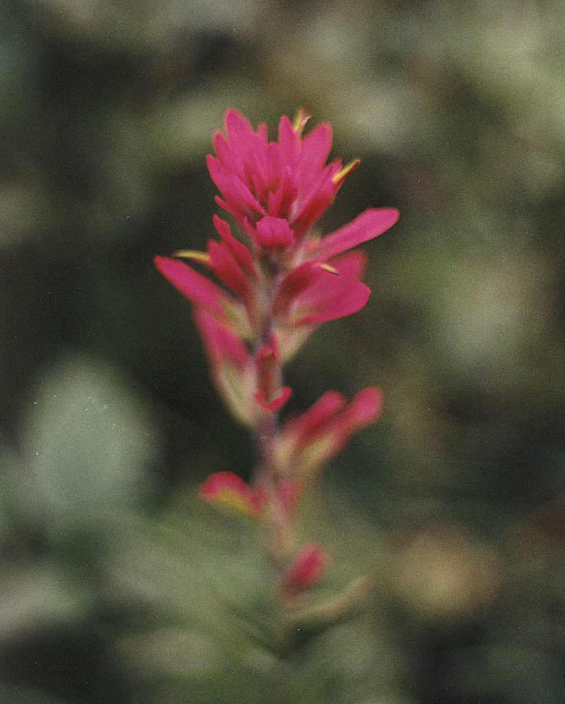
Tuesday Day 2- Despite the heavy frost I was up on the trail by 1030 hrs. Two and half hours and 6.5 k of steep trail later I was at the the Tumbling Pass campsite to have lunch, have a rest and take in the beautiful scenery. Back on the trail again at 1400hrs for the 12.5k hike to Helmet Falls. At the beginning it was steep but eventually it topped out into a beautiful alpine meadow, A short side trip Wolverine Pass gave access to huge mountains stretching away to the west. There were lots of hikers heading the other way but none going in my direction. Because there was bear sign on the trail I kept up some pretty noisy yelling every few minutes. I did not want any surprises and it paid off. While passing through a grove of pines that overhung the trail I heard a rustling in the trees when I looked up I spotted a bear cub about four feet from my head. I took a quick look around for mother bear and pounded on up the trail as fast as my legs could carry me. Thank god there was no sight of mother bear. Nothing but great views of Helmet Creek Falls. By this time the sun was behind The Rockwall as I headed down the steep final section to the Helmut Creek Campsite. I arrived and set up camp around 1830hr. Supper was a bit of a challenge – eating spaghetti with a tent peg was an interesting exercise.
Wednesday Day 3- The morning was gloomy with a threat of rain. By 1030hrs I was on the good clean trail that crossed over the Goodsir Pass and the Kootenay Park / Yoho Park Boundary. My guidebook book appeared to be a little out of date. Suggestions that Goodsir Pass trail was not recommended did not match up with the conditions I experienced. It was a short 4k climb to the top of the pass for spectacular views of Sentry Peak (3,265 metres) and the twin spires of Mount Goodsir (3,561 metres). The trail descended down into Goodsir Creek and the Ottertail River. I by passed the trail to the Ottertail falls. I met another camper on the trail and despite light showers we both made it to the McArthur Creek Campsite at 1400hrs. He pushed on but I decided to camp the night. I settled down and read for a while. By the middle of the night the rain was belting down. Tomorrow was going to be another day and I had no rain gear so it would be decision time. Do I push on or sit out a day waiting for better weather?
Thursday Day 4- A soul searching decision was not required. There was mist over the creek with blue sky and brilliant sunshine overhead.I was on the trail by 10:30 am. It was a very pleasant gradually ascending trail until the new bridge then it got steeper, then steeper and steeper until it topped out a little after 1400hrs. On the way to Lake O’Hara the trail passed by Schaffer Lake. I completed the 13.5k at the campsite by 1500hrs. The park warden briefed the campers on the rules. The area has a bad bear problem so the rules needed to be followed. I had plans for a nice meal at the lodge but no luck. I figured I was too dirty and unkept for a sit down meal so after a snack and a stroll around the lake I set up camp turned in for the night around 200hrs.
Friday Day 5- Heavy rain with thunder and lightning woke me up in the early hours of the Morning, It was right on schedule. The weather forecast called for a thunderstorm around 6am and it arrived right on schedule. As the storm progressed the rain changed to a rustling sound that puzzled me until my tent collapsed under the weight of accumulated snow. There wasn’t sense in trying to get things back to normal and going back to bed. I packed up my gear and headed to the cooking shed to meet the 7:30am bus that was leaving for the Lake O’hara parking Lot. We reached the parking lot by 08:30 It was another beautiful sunny day pretty. In summary it was a 52k hike with four overnights on the trail. It was a good introduction to extended back packing in the park. I learnt I needed to continue to improve my gear. Reduce the weight, a better tent that didn’t collapse under the weight of snow; and some rain gear would be a good start for the following year. And don’t forget the camera next time. I picked up the car from the parking lot and drove back to Marble Canyon to pick up the bike before heading back to Cranbrook. I had hiked a total of 85k, cycled 52k.
@@@@@@@@@@@@
Postscript: Some time in the future I would have liked to redo an extended repeat of the Rockwall Trail by starting at the Floe Lake Trail and continuing all the way through to Lake O’Hara with lots of overnights on the way. Or even better start at Lake O’Hara hike all the way through to Floe Lake then hike all the way back and take lots of photos. That was not to be …. Bear activity closed the Goodsir Pass – Lake O’Hara section for a number of years. Instead I went on to work my way through a list of many of the other backpacking trips and solo day hikes in the parks.
@@@@@@@@@@@@